

Subdivision Development: From the Eyes of an Engineering and Surveying Team
Written by Marisa Marulli and Julia Ribeiro (Coffey Communications)
Reviewed by Cindy Torrez (Coffey Senior CAD Specialist) and Stuart Telford (Coffey Senior Project Manager)
A subdivision may be desired by a developer who wants to construct multiple homes on a large plot of land, a private landowner who wishes to sell parcels independently or a city that needs to section its boundaries.
Read further to understand the initial processes—commencing with engineering and surveying—which anticipate subdivision development.
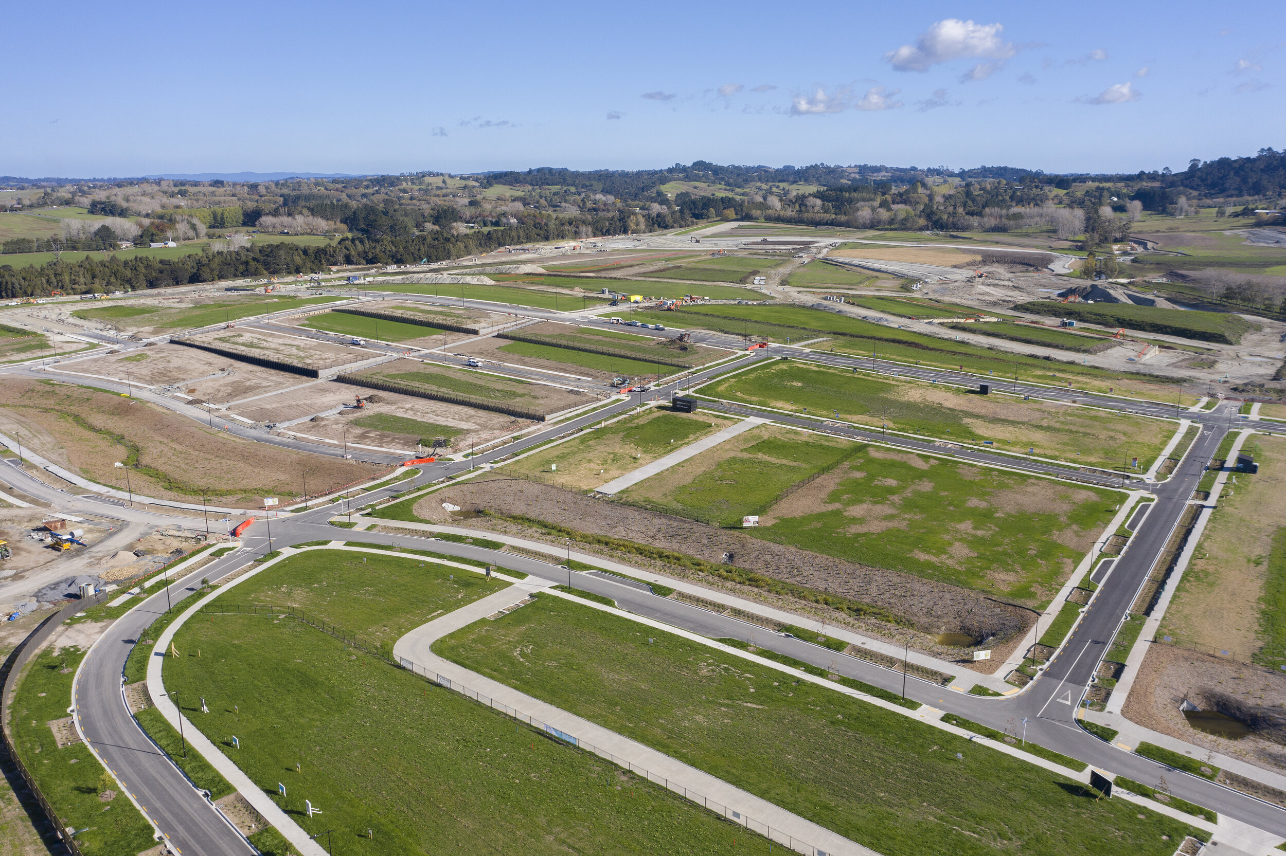
A large parcel of land developed into a new housing subdivision.
What is “Subdivision Platting?”
“Subdivision platting” refers to the legal process of dividing a large piece of land into smaller fragments. Therefore, in the engineering and surveying industry, this term is often used synonymously with “subdivision development.”
The “plat” itself is a legal, officially approved and recorded drawing which depicts the layout of the land split, subsurface utilities and access points.
Who Needs a Subdivision Plat?
Land developers and private landowners are usually the ones to request a subdivision plat, as they would like to divide their land into smaller parcels to either develop commercial or residential properties.
Let’s dive into the various steps that an engineering and surveying firm will take to complete the deliverables associated with this type of project:
Step 1: The Initial Survey
While there may be prior-existing documents describing the project site, usually a project commences with a survey team visiting the land and obtaining more exacting information on locations of utilities and corners.
This more current data is necessary to inform proceeding parties, such as CAD (computer-aided design) specialists and engineers, who will create exhibits and plans for the site’s lot dimensions, building lines, road utilities, water drainage and more.
The survey team (more specifically, a Registered Land Surveyor) will work in close communication with CAD specialists to obtain specifics the specialists may need more information on, or any other unique details pertaining to this site.
Step 2: The Draft Plat Exhibit and Preliminary Construction Plans

Teresa Grove (Coffey Survey Technician) preparing an exhibit on CAD software.
Under the supervision of a Registered Land Surveyor, the CAD specialist will interpret the survey data and use specific computer software to prepare a base drawing, also known as a preliminary plat exhibit.
The draft plat exhibit will outline property lines, conditions and topography.
Simultaneously, the engineer also takes in information from the initial survey to create the preliminary construction plans, also known as preliminary engineering plans.
The construction plan will address the infrastructure design, which includes: road utilities, storm water drainage, grading and more.
Step 3: City and County Submissions and Revisions
Once the draft plat exhibit and the preliminary construction plans are ready, they should be submitted together to the city’s planning and zoning department for review, feedback and revisions.
Once the documents are approved by city planning and zoning, they move on to the county’s planning and zoning department for the same system of review, feedback and revisions.
When approved by county planning and zoning, the documents make one last stop for review by the city council.
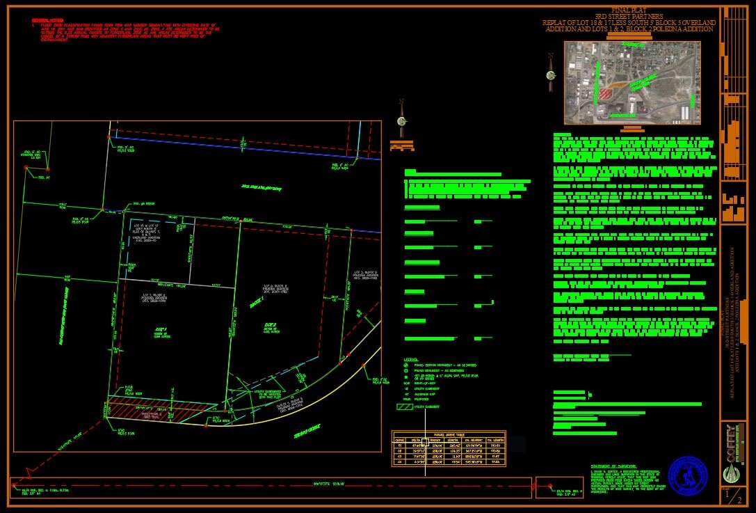
An actual final plat prepared by the Coffey team.
Step 4: Final Plat and Engineering Plans
After all issues recognized by city and county departments are addressed, the final phase initiates: finalizing these documents into final plat and engineering plans.
The final plat is signed by the Land Surveyor prior to being submitted for final approval. The final plat and plans will again be submitted through the same, 3-step review process as the preliminary documents. This time, once approved, the governing entity will sign off on the final plat, which infers final approval of the plat as well as of the final construction plans. Finally, the Professional Engineer will sign the final construction plans that were approved by the governing entities.
It is at this point that the developer may take his or her construction plans and “go to bid,” allowing various contractors to apply for the work.
Advantage of Subdivision Development with Coffey
While the completion of the plat and plans is a typical stopping point for an engineering and surveying firm’s work in subdivision development, at this point Coffey’s engineering team will offer to be available throughout the construction process (proposing Construction Engineering Management) to provide oversight, solve issues as they arise and ensure the schedule stays on track.
In conclusion, the process of obtaining subdivision plats and construction plans requires a land surveyor, CAD specialist and professional engineer to work together.
Since the CAD specialist’s plat exhibit and the engineer’s construction plans need to be submitted together—during the preliminary submission, applicable revisions and final submission—to obtain a signed and approved plat, having an all-inclusive company can accelerate the process of developing a subdivision, avoid project delays and optimize project costs.
The licensed professionals at Coffey Engineering and Surveying can assist with the range of subdivision development services, from the initial survey to the final documents and even construction engineering management.